Physical Features
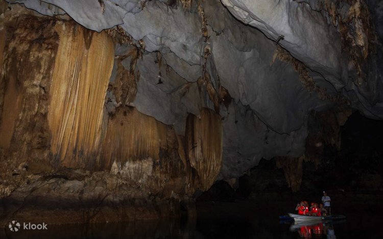
The topography of the Puerto Princesa Subterranean River National Park is highly diverse, ranging from flat lowland terrain to rolling hinterlands, and from forested hills to rugged mountain peaks. Dominating the landscape are three major peaks: Cleopatra’s Needle, the highest at approximately 1,500 meters, Mount St. Paul at 1,028 meters, and Mount Bloomfield at 870 meters. These peaks form part of the extensive limestone or karst outcrop known as the St. Paul Mountain Range, a prominent geological feature within the park.
The St. Paul karst formation stretches for about 11 kilometers, with an average width of 3 to 5 kilometers, covering an estimated area of 35 square kilometers. Geological studies suggest that this limestone formation dates back approximately 16 to 20 million years, making it a significant record of the region’s geological history. Its rugged cliffs, caves, and sinkholes are characteristic of mature karst landscapes shaped by millions of years of natural erosion and water flow.
The park also plays a crucial role as a watershed and catchment area for two major river systems. The Cabayugan River originates from the slopes of Mount Bloomfield, flowing through agricultural lands where it irrigates paddy farms before disappearing beneath Mount St. Paul, where it forms the famous underground river. The Babuyan River, stretching approximately 54 kilometers, is the longest river in Palawan and serves as a vital source of water for surrounding communities. It supports domestic needs and agricultural activities, highlighting the park’s importance not only as a natural wonder but also as a lifeline for local livelihoods.