January 2016

Welcome to Puerto Underground River

One of the New 7 Wonders of Nature


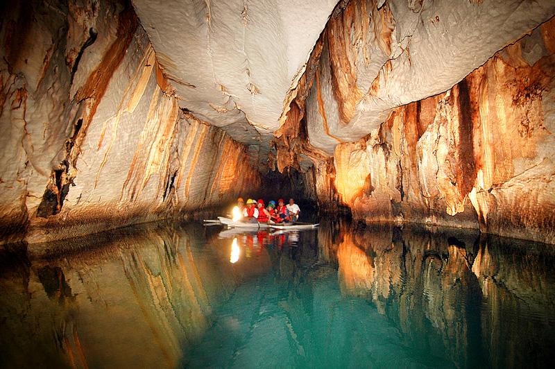
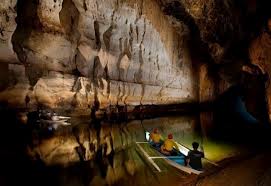
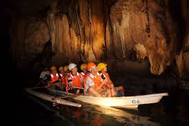
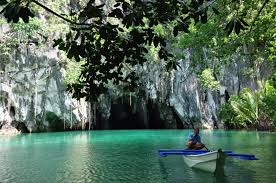
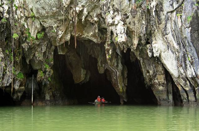
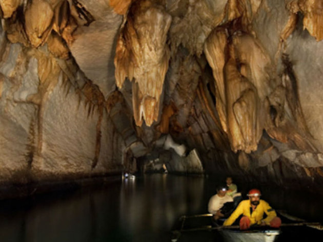
The Puerto Princesa Subterranean River National Park (PPSRNP) is one of the most important protected areas of the Philippines. It features a spectacular limestone or karst landscape withone of the most complex cave systems. It contains an 8.2 km long underground river that flow directly to the sea. The lower half of the river is brackish and is affected by the ocean’s tide. An underground river directly flowing into the sea, and the associated tidal influence, makes it a significant natural phenomenon. The discovery of at least 11 minerals, crystal and egg shape rock formations, and a 20 million year old Miocene age serenia fossil in the cave further add to its scientific value. The Puerto Princesa Underground River is declared as one of the New 7 Wonders of Nature.

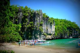
The PPSRNP contains a full mountain to the sea ecosystem and protect forests, which are among the most significant in Asia. It represents significant habitat that are important for biodiversity conservation.

In recognition of the PPSRNP’s globally significant natural value, it was inscribed to the List of World Heritage Sites on December 4, 1999. Inscription on the list confirms the outstanding universal value of the Park and it’s well integrated state of conservation.

The PPSRNP is managed by the City Government of Puerto Princesa based on a program centered on environmental conservation and sustainable development. It has the distinction of being the first national park devolved and successfully managed by a Local Government Unit.
It is managed by the City thru a Protected Area Management Board (PAMB), multi-sector body that provides policy direction and other oversight functions. It is a model for effective protected area management and sustainable tourism in the Philippines.

The Puerto Princesa Subterranean River National Park is a source of pride, and a key element in the identity of the people of Puerto Princesa in particular, and of the Philippines as a whole. The conservation of the Park is a symbol of commitment by the Filipino people in the global efforts to conserve our natural heritage.

Legal Basis

Management of the PPSRNP falls under the scope of Republic Act No. 7586 or the National Integrated Protected Area Systems (NIPAS) Act of 1992, Republic Act No.7611 or the trategic Environmental Plan (SEP) for Palawan Act of 1992 and Republic Act No. 7160 or the Local Government Code of the Philippines Act of 1999.

History

The Park was established on March 26, 1971, by virtue of Proclamation No. 835 issued by the late President Ferdinand E. Marcos. Formerly known as the St. Paul Subterranean National Park, it comprised of 3,901 hectares of terrestrial reservation. Experts later concluded that the size of the Park was inadequate to protect the water shed of the Underground River and the significant biodiversity present. To ensure long-term viability, Proclamation No. 212 was signed by President Joseph E.

Early History

There is no existing document that shows who or when the underground river was first discovered, but it is believed that the islands early inhabitants were the first to know of the existence, but their fear of spirits that they believe inhabit the caves prevented them from exploring the depts. The earliest mention one could hold of would be that of an Assistant Professor of Zoology at the University of Michigan who later became the Secretary of Interior at the first decade of American rule, Dean C.

World Heritage Inscription

The PPSRNP was inscribed to the United Nations Education, Scientific and Cultural Organization’s (UNESCO) list of natural World Heritage Sites on December 4, 1999. It was inscribed based on Criterion (vii) contains superlative natural phenomena or areas of exceptional natural beauty and aesthetic importance and Criterion (x) contain the most important and significant natural habitats for in-situ conservation of biological diversity.

Physical Features

Topography varies from flat terrain to rolling hinterlands, from hills to mountain peaks. The three main peaks are Cleopatra’s Needle (1,500m), Mt. St. Paul (1,028m) and Mt. Bloomfield (870m). the limestone or karst outcrop known as the St. Paul mountain range. The karst is 11 km long, averages 3-5 km wide and covers an area of around 35 sq. /km. It is estimated to be between 16 – 20 million years old.

Climate

There are two types of weather prevailing in the area, the wet and dry season. It is usually wet from June to December and dry and hot the rest of the year. Average temperature is 29 C while the annual average rainfall is 1,148 mm/ yr. The average relative humidity is high at 85%.

Catchment Properties

The Park serves as a catchment to two important river systems, the Cabayugan River that flows down the slopes of Mt. Bloomfield, irrigating picturesque paddy farms before disappearing under Mt. St. Paul to become the underground river, and the Babuyan River measured at 53 km, the longest running river of the island. It provides water to local communities for domestic an agriculture use.